
Ground Penetrating Radar Price: Factors That Affect Your Quote

If you’ve searched for ground penetrating radar prices, you’ve probably noticed most companies don’t list one. That’s because GPR pricing depends on the job in front of the technician, not a number on a website. A small concrete scan before an anchor install and a full utility locate across a commercial site are two different projects with two different price tags. At C&M Subsurface, pricing is built around the actual scope of work rather than a flat menu rate. Here’s what goes into that number and why a quote will always serve you better than a generic price list. Read more about how GPR technology works to get the full picture of how the equipment reads what’s below a surface. What Determines the Price of a GPR Scan? Most GPR providers bill by time on site, either hourly or by the day, with a minimum charge to get a technician out to your location. That minimum covers travel, setup, and the base time it takes to run a proper scan, even on a small job. A five-minute scan and a two-hour scan both require the same drive out, the same equipment setup, and the same review of findings. From there, pricing typically scales up through a half-day rate and a full-day rate for larger projects. C&M structures quotes around this same logic. Job length, not square footage alone, is usually the better predictor of cost, since a small area with dense rebar can take longer to interpret than a larger, simpler slab. Factor 1: Type of Service The kind of scan you need has a direct effect on price. GPR concrete scanning services to locate rebar, post-tension cables, or voids use higher-frequency antennas and tend to move faster once the technician is set up, since the target depth is usually under two feet. A utility locate covers more ground and often calls for both GPR and electromagnetic equipment working together. GPR can detect both metallic and non-metallic lines, including plastic conduit, but an ambiguous return still needs a second method to confirm what it actually is. EM locators can’t see non-metallic lines at all, but they trace the exact path and depth of a live metallic conductor with more certainty than GPR alone. Running both together means one method can confirm what the other only suggests. Cemetery GPR scanning is its own category. These projects usually cover larger, less defined areas and require careful documentation of soil disturbances, which takes longer than a straightforward concrete scan. X-ray was once the standard method for concrete scanning before GPR became the industry preference. See our breakdown of comparing GPR and X-ray methods for how the two compare on cost and speed. Factor 2: Site Size and Complexity Larger sites take more time, but size isn’t the only variable. Dense rebar, congested utility corridors, or a site with multiple obstructions all slow down a scan and require more careful interpretation. Site access changes the timeline too. A tight indoor mechanical room, a vertical wall, or a job that requires scanning around active equipment takes longer than an open, accessible slab. Ground and material conditions play a role as well. Wet clay soil absorbs radar energy and can force a technician to rescan an area to get a usable read. Projects tied to directional drilling often involve exactly this kind of variable soil, which is one reason those jobs get quoted individually rather than off a standard rate. Factor 3: Location and Travel C&M Subsurface started in College Station and is now in Houston and DFW, serving areas across the state. For projects within those areas, travel is usually built into the standard rate. For jobs farther out, mileage and travel time get added to the quote, and a project that requires an overnight stay carries additional costs. This is one of the more overlooked factors in GPR pricing. Two identical scans in two different cities can carry different price tags simply because of the distance a crew has to cover to get there. Factor 4: Deliverables What you need at the end of the scan affects the price as much as the scan itself. On-site markings, where rebar, cables, or utility lines are marked directly on the surface, are usually the fastest and most affordable option since the crew can hand off findings before leaving the site. A written report with in-depth information and imagery takes longer to prepare, since it involves reviewing and organizing the data after the field work is done. Projects that call for 3D imaging add another layer of processing time, since the models need to be built from the collected data rather than marked in real time. C&M’s GPR concrete scanning services can be scoped for markings only, a full report, or both, depending on what the project actually requires. Why Accurate Pricing Requires a Quote, Not a Flat Rate Any company that lists a flat GPR price for every job is either quoting only the smallest possible scope or leaving out variables that will show up on the invoice later. Between service type, site conditions, travel, and deliverables, two projects rarely look alike. A flat rate that looks too good is worth a second look. A rushed scan or a technician who skips a proper interpretation step can miss something, and the cost of a missed utility line or a struck post-tension cable is far higher than the price of the scan itself. C&M Subsurface quotes every job individually based on scope, and proposals typically go out the same day a project is discussed. As a Texas-based, Aggie-owned company, our team works directly with clients instead of routing calls through layers of scheduling, and that direct contact is a big part of why turnaround stays fast. Getting the right GPR equipment on site starts with an honest conversation about scope, not a guess pulled from a price list. Get an Accurate Quote for Your Project Whether you need a concrete scan before coring, a private
Underground Utility Locator Equipment: Tools Used to Detect Buried Utilities

Striking a buried utility line during excavation can shut a project down, create a safety hazard for everyone on site, and result in significant repair costs and liability. The way crews avoid that outcome is by using underground utility locator equipment before any digging starts. Knowing what tools exist, how they work, and why the combination of methods matters is useful whether you are a contractor, engineer, or project manager planning site work. Know Before You Dig Underground utility locating is the process of identifying and marking the position of buried infrastructure before excavation, trenching, or other ground-disturbing work begins. That infrastructure includes electrical conduit, gas lines, water lines, telecom lines, and pipelines, among other things. Most people are familiar with 811, the public “call before you dig” service. What 811 does not cover is just as important as what it does. Public locating services only identify utility-owned lines. Private infrastructure on commercial or residential properties, including water lines, gas lines, electrical conduit, and communication lines, falls completely outside that scope. Private utility detection services cover what 811 leaves out. On most job sites, contractors are working near private lines that 811 will never mark. Without a private locate, those lines are invisible. The Two Primary Tools Used to Locate Underground Utilities Professional utility locators rely on two categories of equipment: ground penetrating radar (GPR) and electromagnetic (EM) locators. These tools detect different targets and produce different kinds of data. Used together, they give locating crews a more complete picture of what is below the surface. Ground Penetrating Radar Ground penetrating radar works by sending short pulses of electromagnetic energy into the ground. When those pulses hit a boundary, a change in material, density, or composition, part of the signal reflects back to the surface. The system measures how long that return trip takes and converts the travel time into depth information. The result is a subsurface profile that builds in real time as the antenna moves across the surface. There is no need to shut down a work area or wait on processed results. The data comes back immediately. What separates GPR from other detection tools is its ability to locate both metallic and non-metallic targets. Electrical conduit, gas lines, and water lines show up in GPR data. So do plastic pipes, voids, and other buried features that EM equipment cannot detect. Depth capability varies based on antenna frequency and site conditions. In typical soil, GPR can detect utilities at depths of up to 8 to 10 feet. Soil composition affects performance significantly. Dry, sandy soils allow the radar signal to travel deeper with less signal loss. Clay-heavy or saturated soils absorb electromagnetic energy, which reduces penetration depth and can limit what the equipment picks up. Need help locating underground utilities in the Dallas area? Learn how our nearby utility locating experts can reveal what’s lying beneath your property. Electromagnetic Locators Electromagnetic locating equipment works by detecting the magnetic field produced by electrical currents traveling through a metallic conductor. The locator traces that field along the path of the line, identifying where it runs and how deep it sits. EM equipment is well suited for tracing metallic utilities including electrical lines, metallic gas pipes, and conductive communication lines. A cable locator is one type of EM tool commonly used for this purpose, tracing the signal along a conductive line to confirm its path and depth. It can follow a line across a large area quickly, which makes it a productive tool for mapping the path of a known utility before excavation begins. The limitation is that EM only works on conductive targets. Non-metallic pipes, plastic conduit, and other non-conductive buried features produce no signal for the equipment to detect. That makes EM locating incomplete on its own for sites where non-metallic utilities may be present. Why One Tool Alone Is Not Enough Neither GPR nor EM equipment is 100% effective in all conditions. Each method has scenarios where it performs well and scenarios where it falls short. GPR can produce ambiguous returns in highly conductive soils or when dense metallic reinforcement is present nearby. EM locating cannot detect non-metallic targets at all. If a site relies on one method alone, there is a real chance that something gets missed. The professional standard for mapping underground utilities is to use both tools together and cross-verify the results. When GPR produces an unclear return, EM can confirm or rule out a metallic conductor at that location. When EM traces a line, GPR can verify depth and identify any adjacent non-metallic features. The two methods close each other’s gaps. This combined approach is also what makes damage prevention reliable rather than approximate. Contractors and engineers need data they can act on with confidence. A locate that uses only one tool leaves room for uncertainty that the combined method eliminates. When Underground Utility Locating Equipment Is Needed on a Project A utility locate should happen before any work that disturbs the ground below 18 inches. That covers excavation, trenching, boring, and any other activity where a buried line could be encountered. Public 811 services should be called before any digging, but as discussed above, they do not cover private infrastructure. On most commercial and developed residential sites, the lines that pose the greatest risk are private. Those require a separate private locate using GPR and EM equipment. Common project triggers include new construction on previously developed land, utility installation or replacement projects, road and infrastructure work near existing buildings, and any excavation in an area where the subsurface is not well documented. If there is any uncertainty about what is underground, that uncertainty needs to be resolved before the work starts, not after something gets hit. What to Look for in a Professional Utility Locating Service Equipment is only part of the equation. The technician operating it determines how useful the data actually is. Reading GPR data requires training and field experience. The same return signature can mean different things depending
GPR vs X-Ray Concrete Scanning: What’s the Difference?

Before you drill, cut, or core into a concrete slab, you need to know what’s inside it. Striking rebar, a post-tension cable, or an unmarked conduit without warning can stop a project cold and cost far more to fix than a scan would have cost upfront. Two non-destructive methods have historically been used to get that picture: ground penetrating radar (GPR) and X-ray. Both locate embedded features inside concrete without cutting into the slab, but they work differently, carry different logistical requirements, and are not equally suited for most job site conditions. How Each Method Works GPR uses pulses of electromagnetic energy to produce a real-time picture of what’s beneath a surface. The antenna emits those pulses into the concrete, and when the signal hits a change in material (rebar, a cable, a void), part of it reflects back. The system measures the return time and converts it into depth and location data displayed on screen as the scan moves. X-ray uses ionizing radiation that passes through the slab and exposes a film or digital detector on the other side. The resulting image shows the internal structure of the concrete with high visual clarity. However, it requires access to both sides of the slab and generates radiation that must be managed before scanning can begin. Want a deeper look at how GPR works? Read this explanation on ground penetrating radar. How GPR and X-Ray Differ on the Job Site The practical differences between these two methods matter most when you’re working against a schedule: Access requirements: GPR scans from one side of the slab. X-ray requires access to both sides, one for the radiation source and the other for the film or detector. On slab-on-grade concrete with no accessible underside, X-ray cannot be used at all. Ground penetrating radar concrete scanning works on floors, walls, ceilings, and columns without that restriction. Radiation and site safety: X-ray equipment emits ionizing radiation, which means personnel must be cleared from the area before scanning begins. On an active job site, that clearance requirement creates real scheduling friction. GPR emits no harmful radiation and can be used on an active site without shutting anything down. Speed and real-time results: GPR delivers data as the technician moves the antenna across the surface, with no waiting. Findings can be marked on the slab immediately so drilling or coring can follow without delay. X-ray imaging may require film to be developed off-site before results can be acted on, and even digital X-ray takes considerably longer per area covered once setup and safety protocols are factored in. Depth information: GPR provides depth readings for every target it detects. When the scan shows rebar at 3.5 inches or a post-tension cable at 6 inches, that data goes directly into how your crew plans the cut. X-ray shows what’s in the slab but does not indicate how far below the surface it sits. What each method detects: GPR locates both metallic and non-metallic targets: rebar, post-tension cables, conduit, plastic pipe, voids, and variations in slab thickness. X-ray produces clearer images but is limited by the density and arrangement of what’s in the slab and the need for dual-side access. Where X-Ray Still Has a Role The main advantage of x-ray scanners is image resolution. The images it produces show fine structural detail that GPR requires more interpretation to match. On heavily congested slabs where multiple reinforcement layers make GPR returns harder to read, or on projects where an engineer needs visual documentation of the slab’s interior, X-ray can provide clarity under those specific conditions. Why GPR Is the Standard for Most Concrete Scanning Work For drilling, coring, cutting, trenching, and anchor installations, GPR scanning is the method that fits. It works on active sites, requires no safety shutdown, gives depth data, detects non-metallic targets, and delivers results in real time. No film to develop, no area to clear, no waiting before the crew can proceed. GPR scanners also work faster, cover more area per hour, and avoid the overhead that comes with radiation safety requirements. If you’re weighing what each method costs for a typical project, take a look at this breakdown of ground penetrating radar costs. Get Accurate GPR Results for Your Next Project C&M Subsurface provides GPR concrete scanning services across Texas, including the Houston, Dallas-Fort Worth, and Austin metro areas. Every scan uses GSSI equipment and a combined GPR and electromagnetic (EM) approach that cross-verifies findings for more reliable results. Whether you need rebar locations before coring, post-tension cable mapping before cutting, or void detection beneath a slab, accurate data gets to your crew before work begins. We respond quickly, schedule around your timeline, and deliver findings in the format your project needs, whether that’s on-site markings, a written report, or both. Get an estimate or call (979) 300-5186 to talk through your next project. Frequently asked questions Can GPR scanning replace X-ray for all concrete scanning applications? Does GPR provide depth information, or just the location of objects? Does the job site need to be shut down for a GPR scan? Can GPR scanning replace X-ray for all concrete scanning applications? For the vast majority of drilling, coring, and cutting applications, yes. GPR works from one side of the slab, provides depth data that X-ray cannot, and requires no safety shutdown. X-ray scanning retains an edge in specific high-congestion or documentation-heavy scenarios, but those are the exception. Does GPR provide depth information, or just the location of objects? GPR provides both. The system measures the travel time of the reflected signal and converts it into depth data, so you know where a target is and how far below the surface it sits before your crew makes a cut. Does the job site need to be shut down for a GPR scan? No. GPR emits no harmful radiation, so there is no need to clear personnel or halt adjacent work. Scans can be conducted on active job sites without disrupting surrounding operations. Can GPR
Utility Mapping
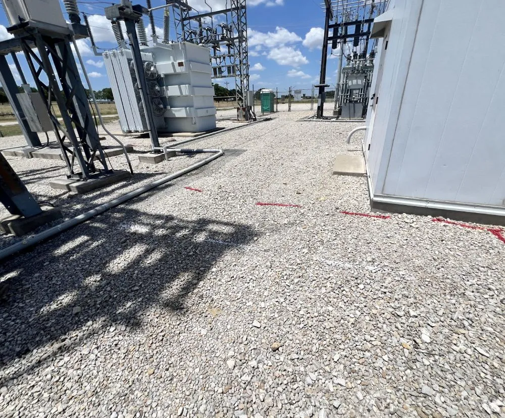
Before any shovel hits the ground, do you really know what is beneath it? Utility mapping gives you the answer before excavation begins, not after a costly utility strike halts your project. At C&M Subsurface, we provide professional utility locating services using ground penetrating radar and electromagnetic technology. Our goal is to give you accurate subsurface data so you can work safely and confidently. If you need ground penetrating radar in Dallas, C&M Subsurface is ready to help. Our experienced team delivers accurate subsurface imaging to keep your project on time and on budget. What Utility Mapping Covers Utility mapping documents the underground infrastructure beneath a site. That includes water, gas, and sewer lines; electrical conduits; telecom cables; and other buried utility lines that run beneath commercial, industrial, and residential properties. Public 811 services only locate utility-owned lines. Private utility infrastructure on commercial or residential properties is not covered. This is where C&M is helpful. As a private utility locating company, we identify and map the full picture of underground utilities that 811 does not touch, giving you accurate existing condition documentation before any ground disturbance takes place. A layered utility map produced by our team shows not just where utilities are, but their depth and orientation, giving project managers the subsurface intelligence needed to plan safe, efficient excavation. How We Do It: GPR and EM Locating C&M Subsurface uses two complementary technologies that work together to provide more complete results than either method alone. Ground Penetrating Radar (GPR) Our ground penetrating radar sends radar pulses into the ground and reads the signals that bounce back. It detects subsurface features, including utility lines, voids, and buried structures, without digging or disturbing the surface. GPR is effective for both metallic and non-metallic utilities. Electromagnetic (EM) Locating We use an EM locator to detect and trace metallic utilities and conductors, confirming their path and depth. EM locating is a complementary technology that cross-verifies what GPR identifies. By combining both, we provide more complete, reliable utility data and reduce the risk of missed lines on your site scan. Results are delivered in real time, on-site. Your project manager gets actionable subsurface data the same day. Our Utility Locating Process Our utility locating service follows a straightforward process built around your project’s actual needs. Request a Quote: Share your project details, and we will provide a clear proposal outlining cost and scope. We turn proposals around quickly because we know construction schedules do not wait. Site Assessment: Our technicians review site conditions, existing records, and any known utility data before the full site scan begins. GPR and EM Scanning: We perform a systematic scan of the project area using GPR and EM equipment. Both methods are used together to provide cross-verified utility data across the underground infrastructure. Data Interpretation and Marking: Identified utilities are marked on site. Depending on your project needs, we can also provide a utility map, GPR scan images, or a written report for your records. Deliverables Tailored to You: Your project manager tells us what you need, and we deliver it. Whether that is field markings only or a full utility map with a KMZ file, we provide accurate utility data in the format that works for your team. Get Accurate Utility Mapping for Your Project Don’t dig blindly. Know what’s below before work begins. C&M Subsurface offers professional utility locating and utility mapping services across Texas. Our team responds quickly, delivers accurate results, and tailors every engagement to your project’s specific needs. Call us at (979) 300-5186 or contact us online to get a quote for your next project. Frequently asked questions What types of utilities can you locate? What does a utility map deliverable look like? How quickly can you mobilize? What types of utilities can you locate? We locate water, gas, sewer, electrical, and telecom cables, including both metallic and non-metallic utility lines. We use GPR and EM locating together to provide the most complete picture possible of underground utilities at your site. What does a utility map deliverable look like? Deliverables are customized to each project. We can provide field markings, a written utility locate report, GPR scan images, or a digital utility map file. We work with your project manager to determine the right format for your team and your project. How quickly can you mobilize? Fast. Quick response time is one of the ways we differentiate ourselves. Call us, and we will have a proposal to you quickly. Scheduling is faster than what most clients have experienced with larger firms. What types of utilities can you locate? We locate water, gas, sewer, electrical, and telecom cables, including both metallic and non-metallic utility lines. We use GPR and EM locating together to provide the most complete picture possible of underground utilities at your site. What does a utility map deliverable look like? Deliverables are customized to each project. We can provide field markings, a written utility locate report, GPR scan images, or a digital utility map file. We work with your project manager to determine the right format for your team and your project. How quickly can you mobilize? Fast. Quick response time is one of the ways we differentiate ourselves. Call us, and we will have a proposal to you quickly. Scheduling is faster than what most clients have experienced with larger firms. about the author
How Does Ground Penetrating Radar Work?

Before you drill, cut, core, or excavate, you need to know what’s below the surface. Striking a post-tension cable, a utility line, or a void you didn’t know was there can stop a project cold, cost thousands in repairs, and put your crew at risk. Ground penetrating radar is how you get that information before the work starts. It’s fast, non-destructive, and gives you real-time data you can act on. GPR scanning in Houston gives project managers and contractors drilling, coring, or excavating across the metro area accurate subsurface data before the first cut. What Is Ground Penetrating Radar? Ground penetrating radar (GPR) is a non-invasive geophysical method that uses pulses of electromagnetic energy to produce images of what lies beneath a surface. It works on concrete, soil, asphalt, and other materials without drilling, digging, or disturbing anything above or below grade. What sets GPR apart from other detection methods is its ability to locate both metallic and non-metallic objects. Rebar, post-tension cables, conduit, voids, plastic pipes, and unmarked graves all show up in GPR data. Most electromagnetic-only tools are limited to metallic targets. GPR is not. The result is a real-time subsurface picture. As the antenna moves across a surface, the system is already building a profile of what’s below. There’s no lab processing, no waiting on results, and no need to shut down the work area. How GPR Works A GPR system has two primary components: a control unit and an antenna. The antenna emits short, high-frequency pulses of electromagnetic energy into the ground or concrete below it. Those pulses travel downward until they hit a boundary, a change in material, density, or composition. When that happens, part of the signal reflects back toward the surface. The control unit measures how long that return trip takes, and that travel time is converted into depth information. Different materials reflect energy in distinct ways. A metallic object like rebar produces a strong, high-amplitude reflection. Voids, post-tension cables, and water lines each produce their own distinct return signature, which is what allows GPR to tell them apart rather than just detecting that something is there. On screen, those reflections appear as hyperbolas. The shape of the hyperbola, its amplitude, and its position in the profile all contain information. An experienced GPR technician reads those patterns and translates them into a clear picture of what’s below, where it is, and how deep it sits. The equipment is only part of the equation. Accurate interpretation is what makes the data usable. What GPR Can Detect GPR is one of the most versatile subsurface detection tools available. In ground penetrating radar concrete scanning, it locates rebar with depth, spacing, and layout detail, as well as post-tension cables, conduit, and embedded utilities. It also maps voids within or below the slab and identifies variations in slab thickness. In soil, it identifies private underground utilities including electrical conduit, gas lines, water lines, and telecom lines. Beyond utilities, it picks up buried structures, foundations, voids, sinkholes, and soil disturbances consistent with unmarked graves or burial sites. That last application is worth noting. GPR is the standard tool for cemetery scanning and forensic site work because it can detect soil disturbances without any physical intrusion. This is important for contractors working near historic properties or undocumented cemeteries. The breadth of what GPR can locate is also why it’s so widely used across industries. Construction, oil and gas, telecom, environmental work, and infrastructure all rely on it for different reasons. What Happens After a GPR Scan? The scan itself is only part of the service. Once the data is collected, findings are communicated in a format your team can actually use on the job. For most concrete scanning projects, that means on-site markings directly on the slab. Rebar locations, post-tension cables, conduit runs, and voids get marked before your crew drills or cores a single hole. There’s no delay between the scan and the work. For larger or more complex projects, technicians provide detailed written reports documenting all findings, including depth information and imagery. On projects requiring a clearer picture of the subsurface structure, 3D imaging is available, producing accurate visual models that support planning, renovation, and restoration work across every stage of a project. The deliverable format depends on what your project requires. If you need markings on site, a report for your records, or both, that gets worked out before the scan begins. GPR for Concrete Scanning vs. Underground Utility Locating The technology is the same, but the setup changes depending on the application. Antenna frequency is the main variable. For concrete scanning, higher-frequency antennas are used. Higher frequency means finer resolution and better detail at shallow depths, which is exactly what you need when you’re trying to locate rebar at 4 inches versus 8 inches, or identify a post-tension cable before coring. The tradeoff is penetration depth. High-frequency antennas don’t go as deep, but for concrete applications, they don’t need to. Most ground penetrating radar concrete scanning work falls within 18 to 24 inches of depth. For underground utility locating, lower-frequency antennas are used. Lower frequency means less resolution but greater depth penetration, which is necessary when you’re mapping utility lines that could be several feet below grade. This is the right tool for private utility locating on a job site before excavation begins. How Deep Can GPR Penetrate? Depth depends on the application and the conditions at the site. For concrete scanning, GPR typically penetrates 18 to 24 inches. In favorable conditions, deeper reads are possible, but most structural elements (rebar, PT cables, conduit, voids) fall well within that range. For underground utility locating in soil, penetration depth can reach up to 8 feet depending on the antenna frequency and site conditions. Soil composition has a significant effect on performance. Sandy, dry soils allow radar energy to travel deeper with less signal loss. Clay-heavy or saturated soils absorb electromagnetic energy, which reduces penetration depth and can limit what the system can detect. High
Environmental Trade Fair and Conference

Earlier in May, our team had the opportunity to participate in the TCEQ Environmental Trade Fair and Conference in San Antonio, Texas. This conference is an annual gathering that pulls together professionals from all over the environmental sector. It is these sorts of events that truly bring out the importance of community and how valuable shared knowledge within this industry is. What is the TCEQ? It is the Texas Commission on Environmental Quality, and its purpose is to protect our state’s public health and natural resources, and to be consistent with sustainable economic development. Their goal is simple: clean air, clean water, and the safe management of waste. How does this commission directly affect you? Simply put, the TCEQ helps enforce environmental laws. Texas is not only home to us now, but to the future generations to come. The progress and developments made today will directly affect tomorrow. It has never been more important to take intentional steps to preserve and construct with a sustainable mindset. How does C&M Subsurface fit into it all Our services, both environmentally and ethically conscious, leave no trace behind. This makes GPR the most efficient and logical first step in determining the scope of any project. Hidden costs within any job aren’t just monetary but can be at a cost the integrity of the surrounding environment. What did we enjoy the most about the conference? Honestly, it was meeting you. Hearing about your projects, your experiences, and how we plan to connect with you in the future. At the end of the day, we are in the business of people, how we can support your goals, make your project run smoother, and keep safety the top priority. about the author
Rebar Scanning Services in Texas

Before you cut, core, or drill into concrete, you need to know what’s inside it. C&M Subsurface provides rebar scanning services across Texas using ground penetrating radar (GPR) to locate rebar, post-tension cables, conduits, and other embedded features within concrete slabs and structures. Our non-destructive scanning gives contractors, engineers, and project managers the accurate, real-time data they need to work safely and avoid costly structural damage. Accurate Rebar Detection Using GPR Technology GPR rebar scanning is one of the most reliable non-invasive methods available for identifying what’s embedded inside concrete. Our equipment emits radar signals into the concrete surface and measures the reflections to produce a clear picture of what’s below. The result is accurate depth, spacing, and layout information that your team can act on immediately, without cutting a single hole. C&M Subsurface uses advanced GPR concrete scanning equipment operated by experienced field technicians. We provide on-site markings, digital reports, or both, depending on what your project requires. When You Need Rebar Scanning Services Rebar scanning is recommended any time work involves cutting into, drilling through, or modifying concrete. Common applications include: Before Cutting or Core Drilling: Striking rebar or a post-tension cable during a core drill is one of the most avoidable mistakes on a job site. Scanning before you drill identifies exactly where reinforcement is located so your team can choose a safe path and proceed with confidence.. For Anchor Installation: Anchor bolts and embedments require precise placement. Rebar scanning confirms clear locations before installation begins, reducing the risk of hitting reinforcement and compromising both the anchor and the surrounding concrete. During Renovation or Structural Modifications: Renovation work on existing concrete structures often involves unknowns. Scanning before any cutting or demolition gives your team a clear picture of the reinforcement layout and helps prevent structural damage during the process. For Electrical or Plumbing Installation: Running conduit, pipe, or other utilities through concrete requires knowing what’s already there. Rebar scanning identifies existing conduits and reinforcement to help crews plan penetrations without unexpected conflicts. What Our Rebar Scanning Services Detect C&M Subsurface GPR scanning identifies a range of embedded features within concrete, including: Rebar Location and Depth We locate individual rebar within the slab and provide accurate depth readings so your team knows exactly how far below the surface each bar sits. Rebar Spacing and Layout Our scans map out rebar spacing and grid patterns across the scan area, giving you a clear view of the full reinforcement layout before any work begins. Reinforcement Patterns Beyond individual bars, we identify how reinforcement is arranged throughout the concrete, including layered rebar, crossing patterns, and areas of dense reinforcement that may affect drill placement. Post-Tension Cables Post-tension cables are under significant tension and striking one during cutting or drilling can cause serious structural damage and safety hazards. Our GPR identifies PT cable locations and depth before any penetration is made. Conduits and Utilities Electrical and communication conduits are often embedded within or below concrete slabs. We locate these features alongside reinforcement to give your team a complete picture of what’s inside the slab. How Rebar Scanning Works Ground Penetrating Radar (GPR): GPR concrete scanning works by sending radar signals into the concrete and recording how those signals reflect off embedded objects. Different materials reflect differently, allowing our equipment to distinguish rebar, cables, conduit, and voids. The data is processed in real time on site, meaning your team does not have to wait for lab results or off-site analysis. Real-Time Data and On-Site Marking: One of the key advantages of GPR rebar scanning is the speed of results. As our technicians scan, findings are immediately visible on screen. We mark the concrete surface directly with the location of rebar, cables, and conduits, so your team can begin work the same day. Reporting and Documentation: When a written record is needed, we provide detailed scan reports that document findings, depth information, and imagery from the scan. Reports are tailored to your project requirements, whether you need a simple summary or a comprehensive documented deliverable. Rebar Scanning vs. X-Ray X-ray has historically been used for concrete scanning, but GPR has replaced it as the standard for most applications. X-ray requires radiation safety protocols, site shutdowns, and specialized coordination. GPR requires none of that. Our equipment is non-radioactive, works in real time, and can be used on active job sites without clearing the area or waiting on safety clearances. For most rebar scanning applications in Texas, GPR delivers the accuracy you need with far less disruption to your project. Our Rebar Scanning Process At C&M Subsurface, our process is designed to be straightforward from first contact to final deliverable. Request a Quote: Share your project details and we will provide a clear proposal covering scope, timeline, and pricing. Schedule Service Once approved, we coordinate site access and schedule the scan around your project timeline. Site Preparation: Our technicians review the area, confirm scan locations, and prepare for efficient fieldwork. GPR Rebar Scanning: We scan the concrete using advanced GPR equipment to locate rebar, post-tension cables, conduits, and other embedded features. Data Verification: Findings are reviewed and cross-checked on site to confirm accuracy before marking or reporting. Marking and Reporting: We provide on-site surface markings, a written report, or both, based on your project needs. Why Choose C&M Subsurface for Rebar Scanning? C&M Subsurface is a Texas-based, Aggie-owned company built on accuracy, reliability, and fast response. We combine advanced GPR technology with experienced field technicians who understand how to read data and communicate findings clearly. Every project gets the same attention to detail, whether it is a single core drill location or a full slab assessment across a large structure. We tailor our deliverables to what you actually need. Some clients need surface markings only. Others need a full documented report. We work with you to determine what makes sense for your project and your budget. Benefits of Rebar Scanning Identifies rebar, post-tension cables, and conduits before cutting or drilling Prevents costly structural damage
Uncovering Washington County’s Hidden History: Cemetery GPR Work Reveals Unmarked Graves

When Working On Construction Or Renovation Projects, Understanding What Lies Beneath A Concrete Surface Is Crucial. Concrete Scanning Is A Powerful Tool That Helps Prevent Costly Damage And Ensures Worker Safety. In This Guide, We’ll Explore The Essentials Of Concrete Scanning, Its Benefits, And Why It’s A Must-Have For Modern Construction. What Is Concrete Scanning? Concrete scanning uses ground-penetrating radar (GPR) and electromagnetic equipment to locate objects like rebar, post-tension cables, pipes, and voids within concrete structures. This non-destructive method gives contractors a detailed view of potential hazards before cutting, coring, or drilling. Key Benefits of Concrete Scanning Prevent Structural Damage: Detecting embedded elements helps avoid accidents and structural failures. Enhance Safety: Knowing what’s inside a slab reduces the risk of injury to workers. Save Time and Money:Avoid costly repairs and project delays by planning around hidden obstructions. When Should You Use Concrete Scanning? Before Drilling or Cutting: Ensure you won’t hit any critical elements. Pre-Renovation Assessments: Understand a structure’s integrity before making changes. Routine Maintenance: Check for internal wear or potential issues over time. How Concrete Scanning Works Technicians use GPR devices to send signals into concrete. When signals hit an object, they bounce back, creating data points that form an image of what lies below the surface. This technology works in real time, providing immediate insights. Best Practices for Accurate Results Hire Experienced Technicians: Skilled operators know how to interpret GPR data accurately. Scan in Multiple Directions: Scanning from various angles improves detection accuracy. Use High-Quality Equipment: Reliable scanners, like the GSSI Flex NX, offer better resolution and clarity. Boosting Your Project’s Success Incorporating concrete scanning into your workflow isn’t just about avoiding problems — it’s about setting your project up for success. With the right tools and expertise, you can work confidently, knowing your team is safe and your structure is secure. Are you ready to integrate concrete scanning into your next project? Contact us today to learn more or schedule a service! By following these practices and understanding the technology, you’ll not only enhance your project’s safety but also improve your site’s overall efficiency — a win-win for any construction professional. about the author
The Importance of Concrete Scanning Before Cutting into Grade Beams

When Working On Construction Or Renovation Projects, Understanding What Lies Beneath A Concrete Surface Is Crucial. Concrete Scanning Is A Powerful Tool That Helps Prevent Costly Damage And Ensures Worker Safety. In This Guide, We’ll Explore The Essentials Of Concrete Scanning, Its Benefits, And Why It’s A Must-Have For Modern Construction. What Is Concrete Scanning? Concrete scanning uses ground-penetrating radar (GPR) and electromagnetic equipment to locate objects like rebar, post-tension cables, pipes, and voids within concrete structures. This non-destructive method gives contractors a detailed view of potential hazards before cutting, coring, or drilling. Key Benefits of Concrete Scanning Prevent Structural Damage: Detecting embedded elements helps avoid accidents and structural failures. Enhance Safety: Knowing what’s inside a slab reduces the risk of injury to workers. Save Time and Money:Avoid costly repairs and project delays by planning around hidden obstructions. When Should You Use Concrete Scanning? Before Drilling or Cutting: Ensure you won’t hit any critical elements. Pre-Renovation Assessments: Understand a structure’s integrity before making changes. Routine Maintenance: Check for internal wear or potential issues over time. How Concrete Scanning Works Technicians use GPR devices to send signals into concrete. When signals hit an object, they bounce back, creating data points that form an image of what lies below the surface. This technology works in real time, providing immediate insights. Best Practices for Accurate Results Hire Experienced Technicians: Skilled operators know how to interpret GPR data accurately. Scan in Multiple Directions: Scanning from various angles improves detection accuracy. Use High-Quality Equipment: Reliable scanners, like the GSSI Flex NX, offer better resolution and clarity. Boosting Your Project’s Success Incorporating concrete scanning into your workflow isn’t just about avoiding problems — it’s about setting your project up for success. With the right tools and expertise, you can work confidently, knowing your team is safe and your structure is secure. Are you ready to integrate concrete scanning into your next project? Contact us today to learn more or schedule a service! By following these practices and understanding the technology, you’ll not only enhance your project’s safety but also improve your site’s overall efficiency — a win-win for any construction professional. about the author
C&M Subsurface Partners with Site Twin to Enhance Utility Locating Services in Navasota, Texas

When Working On Construction Or Renovation Projects, Understanding What Lies Beneath A Concrete Surface Is Crucial. Concrete Scanning Is A Powerful Tool That Helps Prevent Costly Damage And Ensures Worker Safety. In This Guide, We’ll Explore The Essentials Of Concrete Scanning, Its Benefits, And Why It’s A Must-Have For Modern Construction. What Is Concrete Scanning? Concrete scanning uses ground-penetrating radar (GPR) and electromagnetic equipment to locate objects like rebar, post-tension cables, pipes, and voids within concrete structures. This non-destructive method gives contractors a detailed view of potential hazards before cutting, coring, or drilling. Key Benefits of Concrete Scanning Prevent Structural Damage: Detecting embedded elements helps avoid accidents and structural failures. Enhance Safety: Knowing what’s inside a slab reduces the risk of injury to workers. Save Time and Money:Avoid costly repairs and project delays by planning around hidden obstructions. When Should You Use Concrete Scanning? Before Drilling or Cutting: Ensure you won’t hit any critical elements. Pre-Renovation Assessments: Understand a structure’s integrity before making changes. Routine Maintenance: Check for internal wear or potential issues over time. How Concrete Scanning Works Technicians use GPR devices to send signals into concrete. When signals hit an object, they bounce back, creating data points that form an image of what lies below the surface. This technology works in real time, providing immediate insights. Best Practices for Accurate Results Hire Experienced Technicians: Skilled operators know how to interpret GPR data accurately. Scan in Multiple Directions: Scanning from various angles improves detection accuracy. Use High-Quality Equipment: Reliable scanners, like the GSSI Flex NX, offer better resolution and clarity. Boosting Your Project’s Success Incorporating concrete scanning into your workflow isn’t just about avoiding problems — it’s about setting your project up for success. With the right tools and expertise, you can work confidently, knowing your team is safe and your structure is secure. Are you ready to integrate concrete scanning into your next project? Contact us today to learn more or schedule a service! By following these practices and understanding the technology, you’ll not only enhance your project’s safety but also improve your site’s overall efficiency — a win-win for any construction professional. about the author